
It’s another chilly start Tuesday morning across DFW, but it’s not quite as cold as Monday morning. All areas are waking up to above-freezing temperatures, but most locations still feel like the 30s.
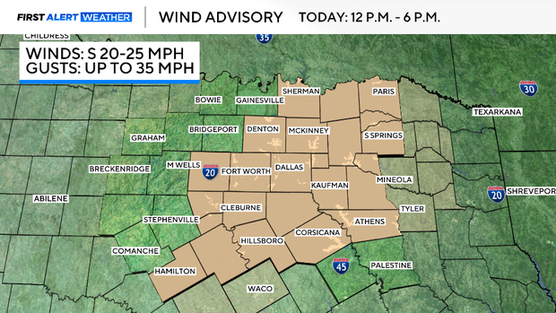
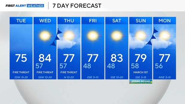
You’ll need a jacket at least to start your day. By Tuesday afternoon, high temperatures will soar into the mid-70s thanks to gusty southwest winds. A wind advisory is in place with gusts up to 35 mph. This, in combination with how dry it has been, will increase the fire threat.
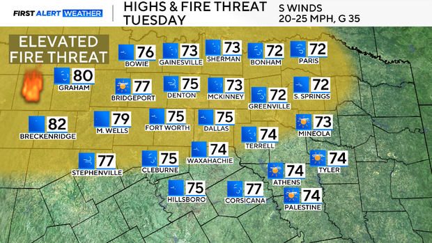
The fire danger will linger through Thursday, but winds will be less gusty over the next few days, which will limit the threat.
An upper-level ridge of high pressure to the south will help to keep temperatures well above average. Temperatures will drop some on Thursday as a cold front moves through the area. Instead of the 80s, DFW will fall into the 70s, but temperatures will still stay above average.
It will continue to stay dry through the end of February and into the first couple of days of March. After that, some models signal rain chances may return to the forecast.
Leave a Reply